The Srepok basin covers 30.100 square kilometers. Among the big rivers in the Central Highlands of Vietnam, it’s the second, only to the Se San river in the provinces of Gia Lai and Kon Tum. With 6 dams (Dray Hling, Buon Kuop, Buon Tua Srah, Srepok 3, Srepok 4 and Duc Xuyen) bringing electricity to the national grid, it is nicknamed “the river of light”.
However, the consequences to the communities along the two banks are bitterly antagonistic.
The thirst under the dam
The Central Highlands is about to welcome the dry season. The sun is pouring fire into Ea Tung village (Ena commune, Krong Ana district, Dak Lak province). The waving breeze and the tree’s shadow are not enough to dispel the heat in Le Van Trong’s house even though the house is rather close to the Srepok riverside.
Trong has witnessed more than 40 autumns passing by the river, his life is closely linked to the river, but now the scenes of locals of all ages swimming and relaxing in the water are only nostalgic memories in his mind.
This year, the river dried up. Because of the water shortage, Trong’s family was forced to spend more than $1000 for drilling wells twice, but the water is lime-contaminated, and can only be used for bathing.
“We must go very far, to the stream in the forest, to fetch water,” Trong said with a sad voice.
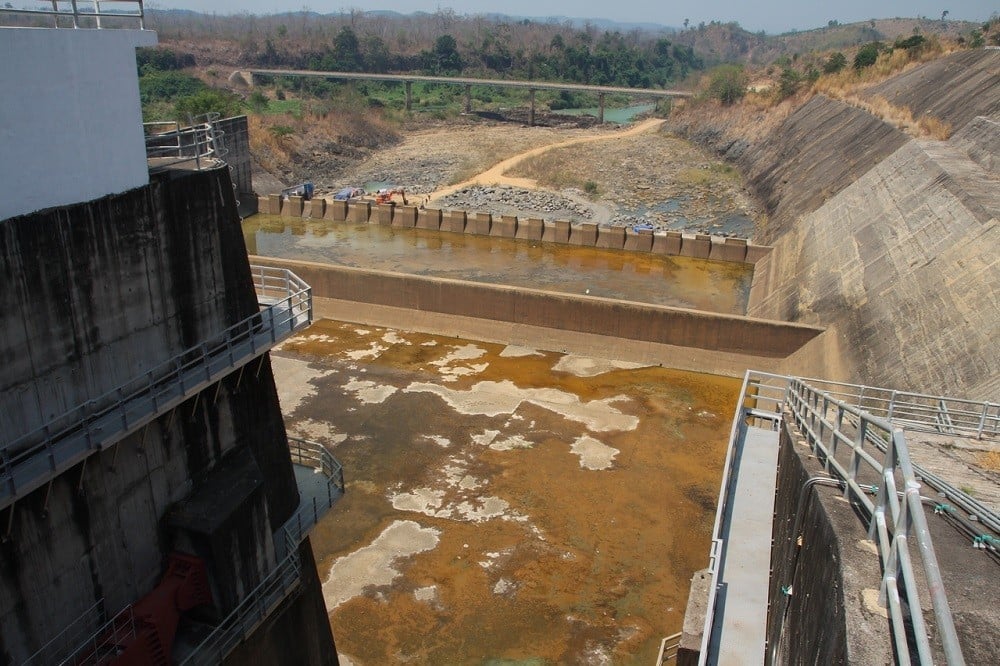
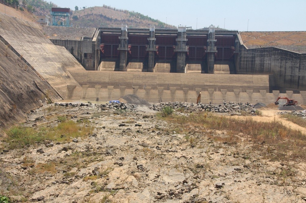
The Buon Kuop dam in Dak Lak province (Photo: Thien Y)
The data from the Vietnam Rivers Network (VRN) says that thus far 6 dams with the total capacity of 870 MW, including Dray H’linh, Srepok 3, Srepok 4, Srepok 4A, Buon Kuop, and Buon Tua Srah, have been built along only 126 kilometers of the Srepok river running in the territory of Vietnam.
But the most controversial dam is Srepok 4A, which blocks the river’s flow and diverts water into a 15 kilometer man-made canal for power generation.
The capacity of the Srepok 4A dam is 64 MW, taking water directly from the discharge channel of another dam (Srepok 4), the water will follow a canal which runs across 3 communes of Ea Wer, Ea Huar and Krong Na (Buon Don district).
After serving the dam, the water is discharged to the Srepok river, but the volume of flow is only 8.23 cubic meters per seconds; additionally increased with an average of about 9 cubic meter per seconds by some small streams.
This volume is only 1/26 of the river’s natural flow which accounts for 220 cubic meter per seconds.
The 20 kilometers of water-diverted river is a part of the natural boundaries of the Yok Don National Park.
On the other hand, the dry river will be more favorable for illegal loggers entering the core area of the national parks for deforestation and transporting illegal timber.
Thousands of residents living along the river, therefore, have been suffering from water shortage, and many cropfields were abandoned.
The tourism sites located along the river, in Buon Don district also fall into the edge of closing.
Ms. Nguyen Le Thanh Thao, manager of Thanh Ha ecotourism resort, complained that in the recent two years, her resort had been facing more and more difficulties. Her resort is nearby Bay Nhanh waterfall, but now the waterfall has run dry because of the dams.
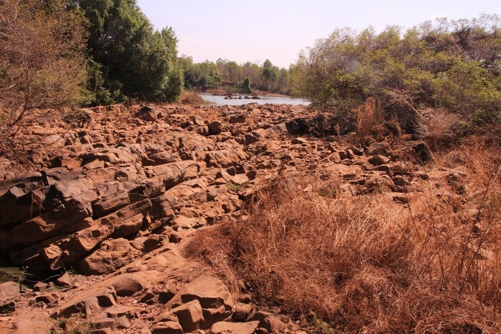
One section of Srepok river dried up by Serepok 4A dam (Photo: Thien Y)
“We need the natural flow of the Srepok river for our operations; tourists come here for watching the waterfall, no one wants to come here just to watch the rocky riverbed,” Thao said with depression.
This year, the organizers of the elephant swimming crossing the Srepok river contest which is an iconic event for the Dak Lak province’s tourism, had to send a letter to the hydropower companies to “ask for” water to maintain the event.
Recently, Dak Lak province has invested over 10 billion VND for constructing a dam in Tri A village, Krong Ana commune, Buon Don district to keep water for the local communities.
In fact, no agency is specifically responsible for monitoring stakeholders to implement fully the preservation of the environment and fisheries in the river’s ecosystem.
There is also no relevant research on the damage to the fisheries caused by a series of dams blocking the Srepok River, but 200 fish species in the basin, including 14 species listed in the Vietnam Red Book, such as zebrafish (Probarbus jullieni Sauvage), hemibagrus (Mystus wyckioides), fish muffle (Bangana behri)… are now in danger of extinction.
The struggle with discharging flow
Duc Xuyen is a poor commune of Krong No district (Dak Nong province). From the center of the district, I spend almost 2 hours to overcome nearly 30 kilometers of bumpy road to reach Krong Kno river bank, one of two main tributaries of the Srepok.
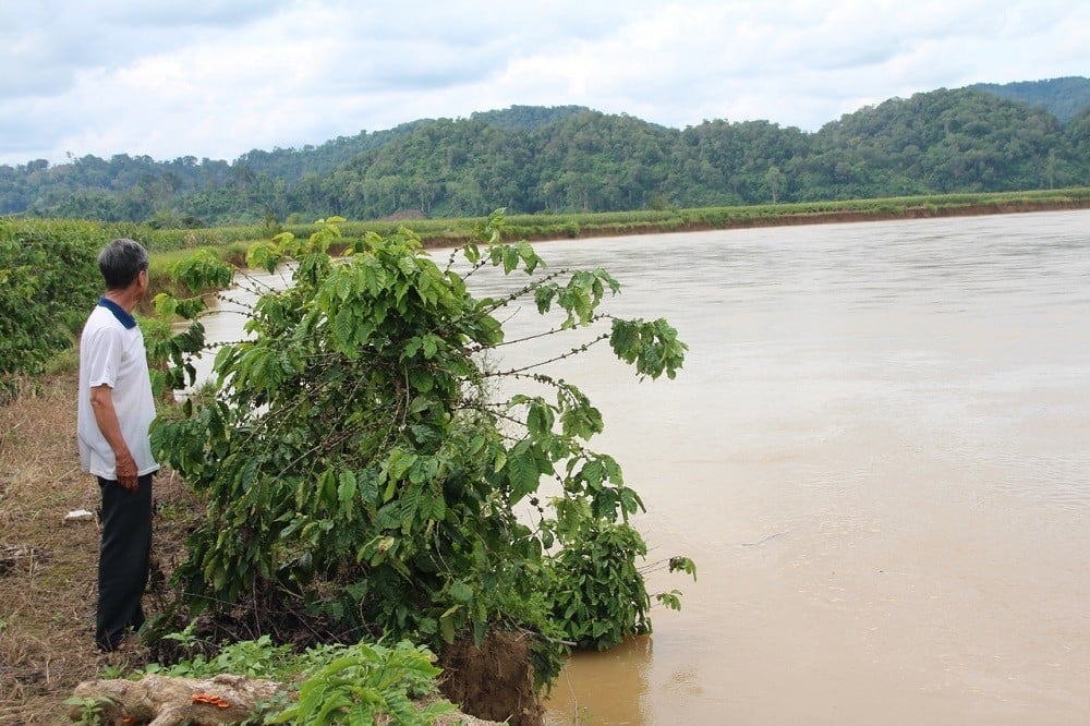
The local residents mainly survive on coffee cultivation, but now their fields have been gradually sliding into the river, due to the daily discharge cycle of the Buon Tua Srah Hydropower dam, which is the regulation reservoir of the whole hydropower chain along the Serepok river.
Mr Dang Xong, 54, a local resident of Tran Hai village (Duc Xuyen commune) took us to his coffee farms nearby the river bank. Pointing to the coffee trees leaning into the river, he said: “I have planted coffee here for more than 30 years. In the old days, the Krong No rivers are small enough for wading across.
But since 2009, when the upstream Buon Tua Srah started the operation, the riverbank landslides occur more and more, the riverbed has been extended dozens of meters each side.
After 7 years, my family lost nearly 1 hectare because of landslides. The coffee rows nearby the river’s edge can be swept away at any time.”
Mr. Nguyen Dang Tin, 35, whose farm next to Mr Xong’s field, said: “In recent years, nearly 5 acres of my family’s cropland of are buried in the riverbed. We are farmers, our lives depend on farming land. The eroded areas are very fertile soil, we always get very high yield, with even cash crops or perennials.”
The Buon Kuop dam in Dak Lak province (Photo: Thien Y)
Not only in Duc Xuyen, dozens of hectares of riverbank agricultural land in Quang Phu, Nam N’Dir, Dak Nang communes (Krong No district) have also sharply eroded.
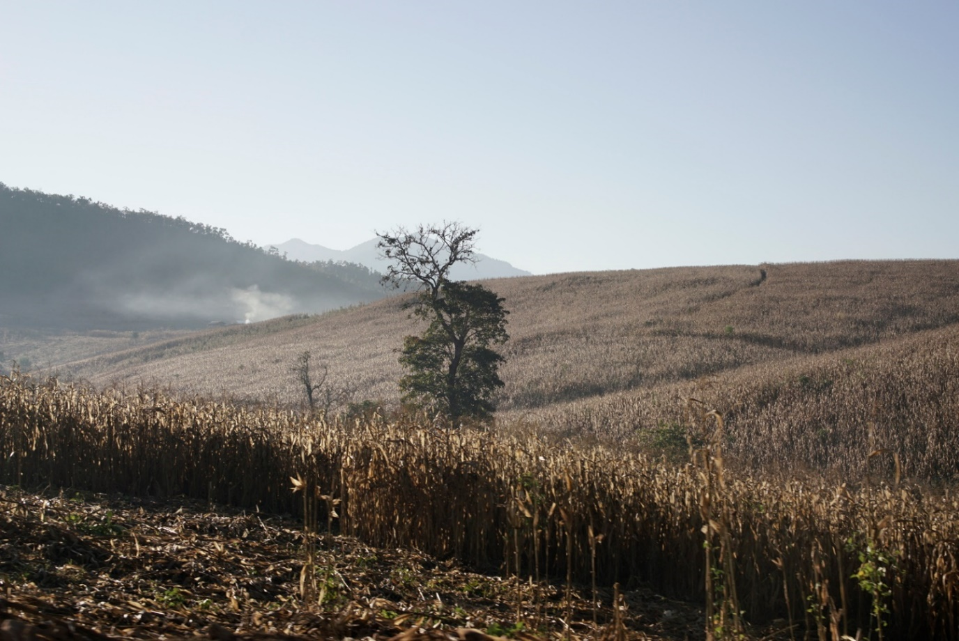
Mr Dang Van Quang (Quang Ha village, Nam N’Dir commune) tried hard to keep himself from bursting into tears, pointing to upcoming harvest of cornfields, which are about to slide into the water, and said mournfully: “A few days ago, the cornfields were still on the shore, but now they all slide off into the river! Every year, riverbank cultivation households like us lose several acres of land, I don’t know in the few coming years if we’ll still have any land for farming or not? ”
Both the people and the local authorities agree that the landslide only occurred since the operation of the Buon Tua Srah in 2009.
According to vice chairman of the Nam N’Dir CPC Nguyen Van Trang, the construction of the hydropower plant affected badly to the ecosystem and the flow of the Krong No river.
The dam’s operation process not only causes sharp soil erosion along the two banks, devastating the fishery resources in the river, but also put farmers into the water shortage for cultivation.
In the dry season, the water pumping for irrigation depends entirely on the operation of the dam. Meanwhile, the discharge cycle of the dam deepens the riverbed, causing many more difficulties for irrigation.
Mr Nguyen Hung, vice chairman of the Duc Xuyen CPC, states firmly that “Since the operation of the Buon Tua Srah dam so far, the process of opening and closing regulation valves cause landslides and flooding to hundreds of hectares of downstream farming land every year.
Although the locals receive compensation, they are still very angry and constantly propose requests to get back the cultivation land. They said that a hydropower operation for money that makes local people poorer is unacceptable.”
This is part 1 of 3, in the author’s “Sorrow of Dams” series.
This story was produced by a local journalist with support from The Mekong Eye and Mekong Matters Journalism Network and is published under a pseudonym at the request of the journalist. The journalist and their outlet retain full editorial and copyright control.
Lead Photo: Croplands of locals in Dak Nong province is eroded by discharging water of Buon Tuasrah dam (Photo: Thien Y)


