Ho Chi Minh City is pressing forward on a 41 km-long sea dyke to be the cornerstone of a new flood management strategy. Experts point out, however, that such a barrier will do little to address the major factors contributing to thy city’s inundation, and that far more attention needs to be paid to non-technical strategies if real flood resilience is to be attained. This is Part 2 of Mekong Eye’s investigation into the HCMC’s Vung Tau – Go Cong Sea Dyke project. Part 1, “Noose or life ring: Ho Chi Minh City’s proposed super dyke” can be viewed here.
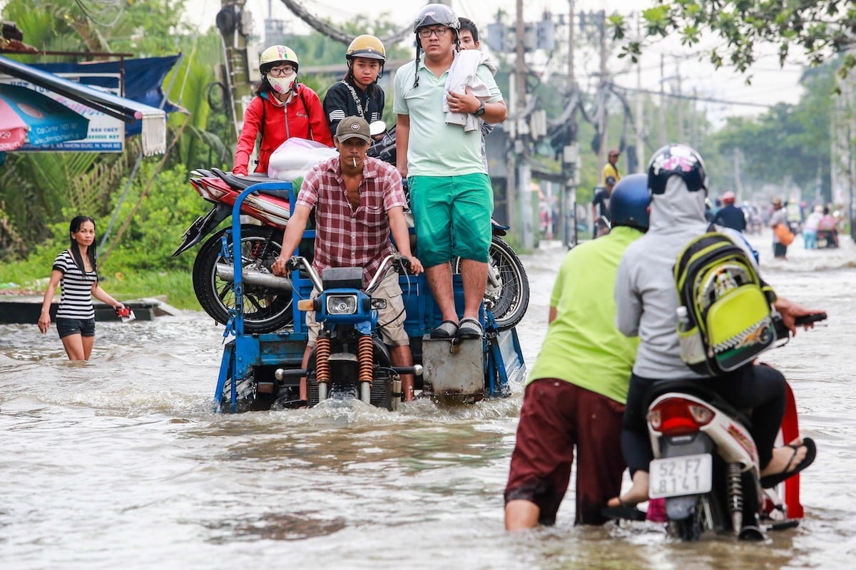
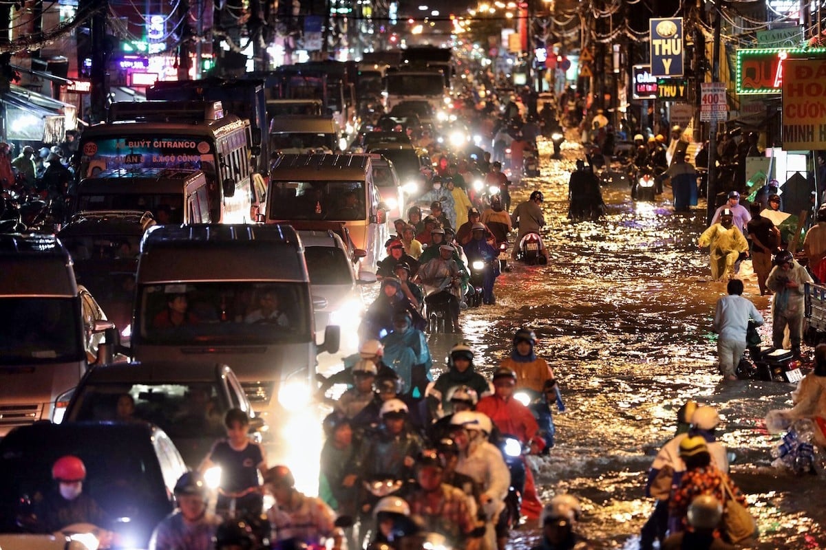
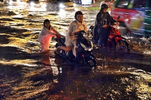
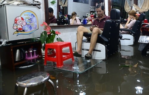
In the late afternoon of May 19 this year, the rainy season’s heaviest deluge dropped 119 mm of rain over three hours onto Ho Chi Minh City (HCMC). More than 30 major roads were submerged, taking up to three more hours before they began to drain. Several communities in lowland areas were flooded up to 60 cm. Polluted water and solid waste inundated houses causing extensive damage, along with transportation congestion.
The routine life of locals was once again disturbed, as this metropolis of 13 million people coped with the fact that city planners are failing them. The flooding situation in HCMC is largely the result of allowances made for inappropriate urban expansion as money and politics work to fuel the city’s flooding vulnerabilities.
Short-term solution
Scientists, urban planners and disaster preparedness experts have been stressing for years that HCMC holistically address a myriad of problems contributing to increased frequency and severity of flooding. Areas of the city, many that are already half a meter below sea level, are sinking further due to groundwater depletion. Largely unmanaged property development has filled in runoff areas and canals. Existing drainage systems are neither being effectively maintained nor expanded, while plans for installing water retention mechanisms go unimplemented. Meanwhile, planners have not heeded the warnings of increased urban flooding resulting from more sever rainfall events and rising tidal surges brought on by climate change.
Rather than employ the technical sophistication and vision necessary to tackle the complexity of HCM City’s urban flooding situation, most discussions and resources are now being channeled toward a single sea dyke costing upwards of $US 20 billion, even though such a dyke will not address the city’s key flooding challenges. Indeed, the Vung Tau – Go Cong Sea dyke is designed for tidal control and keeping sea water out—not decreasing the accumulation of extensive rainfall upstream and accelerating its evacuation from urban areas into the sea.
Kim Minh Company surveyed hundreds of flooding sites within HCM City. Only 14 – 28 percent of these sites were identified as primarily being affected by tidal floods, whereas 50 – 68 percent were affected by rainfall. Other cities of Vietnam like Ha Noi, Da Lat, Buon Me Thuot are similarly affected by rainfall much more than tidal action.
The local authority has implemented different flood control projects under two major programs: HCM City 2020 Urban Drainage System Master Plan (Plan 752) and HCM City Tide Flood Control Master Plan (Plan 1547). Although these plans have been in place for more then a decade, lack of resources has limited their implementation.
According to the HCMC Steering Center of Flood Control Program (SCFC), within the 650 square kilometer management area, only 2,593 kilometers of the required 6,000 kilometers of drainage channels have been completed or renovated.
Worse still, of the 4,369 km of rivers, canals and creeks in the four main catchments that were targeted for flood management upgrades, only 60 km have been completed.
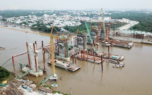
The city has finished just two of its 12 planned wastewater treatment plants, 64 km out of 149 km of dykes along the Saigon River, and one-tenth of a major tidal control sluice. Moreover, not a single one of the 104 flood retention ponds authorized has been built.
Mr. Do Tan Long, Department Chief of Drainage System Management of SCFC said that there were available technical solutions to address flooding; however, flooding still happened because of financial shortage.
Others add that since climate change impacts were not incorporated into the design of these plans, they must be revised to accommodate the full range of changes forecasted for temperature, rainfall, sea-level rise, coastal erosion and land subsidence.
For example, drainage systems have been designed for rainfall levels over three consecutive hours reaching 95.91mm, coincident with a tidal peak of 1.32m. However, recent observations have recorded rainfall events delivering from 100 – 122mm of water over just one hour coincident with tidal peaks up to 1.72m. Moreover, the affected urbanized area has expanded 1/3 to more than 800 square kilometers since these plans were conceived.
Based on analysis employing differential Interferometric Synthetic Aperture Radar (D-InSAR), Ass. Prof. Dr. Le Van Trung, head of the Department of Information System of Environment and Natural Resources, Hochiminh City University of Technology, has documented that land subsidence up to 5-10mm per year is occurring in a number of districts. Furthermore, the research shows that from 2010 – 2017 there were areas affected by flooding that had previously not been impacted.
“Apart from updating the terms of references for the previous master plans, I propose quickly upgrading the urban drainage network and creating all necessary water retention ponds,” says Ho Long Phi, former director of the Center of Water Management and Climate Change, at Hochiminh City National University. “This should be the main, short-term objective, and could yield immediate effectiveness. We should not build a sea dyke or a dam when we have such limited financial resources.”
Flood management is a multi-disciplinary problem
Historically, HCMC’s efforts to address flooding have tended toward the short-term fix: adding fill to some low-lying areas, clearing clogged sewage systems and drainage canals, and investing in equipment to pump-out inundated sites. Even the two flood control master plans that have emerged over the past twenty years, says Dr. Ngo Viet Nam Son, an architect and an urban planning expert, have emphasized infrastructure projects to “control” floods, not soft approaches that could decrease the need for such protections in the first place.
Dr. Son says real planning would stress flood management, not control—working with floods, not assuming floods can be structurally contained. This would include land-use policies with dedicated areas for flood waters to inundate when necessary as part of a coordinated land-use strategy amongst all relevant government agencies.
Currently, the most heavily inundated areas are those that had their lakes and canals removed. Construction density in such areas have been allowed to increase up to ten-fold without appropriate open space areas for water to drain. The Nguyen Huu Canh street is a typical case. Despite its location next to the Saigon river, water levels there are still higher than the river’s during heavy rainfall because of the poor drainage system.
Ngo Viet Nam Son proposes establishing ratios for the amount of open space needed relative to the amount of land permitted for development. Not only must existing lakes and water courses be strictly protected, but additional green space and water detention ponds must also be created.
He adds that such approaches should be universally applied throughout the municipality. He discounts a common belief that, “The development of lowland areas in the South may result in inundation (due impeding drainage) of the upland in the North.”
There’s no scientific base for this, he says. Urban development in the Southern lowland is feasible so long as a rational development ratio and good landscape architecture solutions are devised that incorporate flood management needs.
Nonetheless, considering economic efficiencies and climate change concerns, Mr. Son recommends prioritizing the development of the upland areas.
Moreover, separate strategies are needed for new urban areas as compared to renovating existing communities. It is easier to manage floods within new urban areas, including Thu Thiem and Cu Chi, provided they are well-designed with sufficient ground elevation and drainage infrastructure.
So far, authorities have struggled with renovating existing areas, says Dr. Son. He proposes categorizing communities according to their specific needs. For upland areas, emphasis should be placed on development density and incorporating water retention areas. Submerged areas should be assessed as to their ability to be fully protected. Son argues that some areas will need to accept some flooding, as occurs in developed cities like London. Residents will cooperate so long as they are assured that sufficient warnings and support will be forthcoming should flooding occur and that this is complimented by reasonable adaptation measures implemented well in advance.
In the past ten years, the local authority has allocated about 30,000 billion VND (US$1.3 billion) for flood control projects. This could increase to 96,000 billion VND (US$4.17 billion) If those plans are to be fully implemented. Much of this investment has been in response to new development, which Ho Long Phi argues is inappropriate. He feels authorities should compel property developers and their investors to finance flood detention facilities, be they above or below ground.
Experts also recommend that householders and building owners be required to install and manage water detention or infiltration infrastructure depending on the surface area of their roofs, building footprint and land area.
Accommodating Newcomers
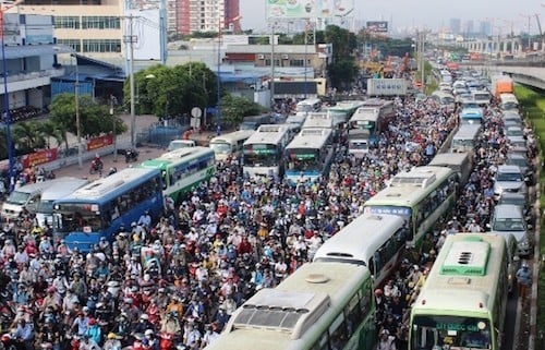
Officially, HCM City’s population is about nine million people. Unofficial estimates, however, put the figure at about 13 million, with it increasing at a rate of 200,000 – 250,000 people per year. Much of this growth is from migration, some fleeing declining agricultural productivity in rural areas due to climate change. Many of these migrants work in urban services, driving up density levels and infrastructure burdens relative to those gaining employment in peripheral industrial areas.
Experts suggest that much more attention should be paid to targeting economic development into to suburban areas to relieve stress on urban infrastructure. This should be done, however, with provisions for green belts and prohibiting vacant land from mass sale.
Assoc. Prof. Dr. Nguyen Minh Hoa, an expert in urban planning and development and a member of the HCM City Council of Planning and Architecture, proposes that municipal authorities promote a development model that focuses on high technology agriculture to sustain some of the city’s food needs. Investment can be targeted to retain farmers through supporting high-value crop cultivation and the promotion of eco-tourism and homestay services. Spreading the population to neighboring areas, however, must come with the strengthening of public services such as education and health care. Presently, suburban development is haphazard and spontaneous, with no integration into a wider geographical economic development strategy, particularly one that takes into consideration decreasing the migration burden on those densely populated areas most vulnerable to flooding.
As the 2018 rainy season begins to ebb, yet another 400mm of rainfall drenched HCMC residents during the final Sunday of November. It is the new normal for this economic hub driving the region’s strongest economy. But unless HCMC’s leadership can embrace the multifaceted approaches needed to effectively respond to this worsening problem, many communities may be spending more time trying to dry out then furthering the larger development interests of the country.
Part 1: Noose or life ring: Ho Chi Minh City’s proposed super dyke
Story in Vietnamese language: Chống ngập TP.HCM: Tranh cãi “siêu” đê biển


