Viet Nam’s rivers are running out of sediment
Decades of building hydropower dams and sand mining have almost depleted Viet Nam’s rivers of sediment. Coastal residents and downstream farmers are bearing the brunt.
By NGUYỄN THU QUỲNH
NOVEMBER 18, 2024
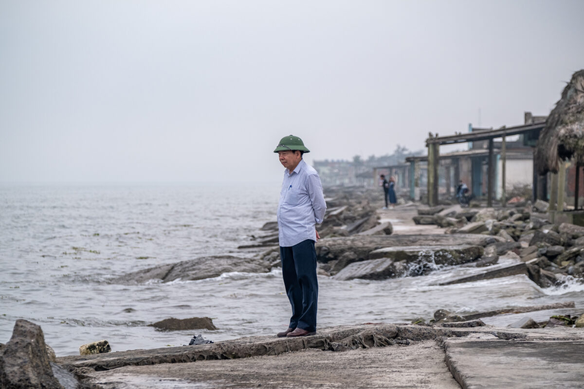
NAM ĐỊNH, VIỆT NAM – When Vũ Thanh Thuận started working as Deputy Head of the Hải Hậu Dike Management Station in 1989, where he stands now used to be a vast alluvial plain up to one kilometer wide.
In the past 40 years, the centuries-old plain has shrunk and disappeared, exposing the dike to larger, deadlier waves.
As the sediment load in the rivers declined, the Hải Hậu dike suffered from severe erosion and started collapsing in the early 1990s. In 1995, the local government built another dike further inland. The old dike only lasted until 2005, when typhoon Damrey hit.
“The waves slammed against my house, water rose over my roof, the ground collapsed and rocks were flung into the air,” Mai Thị Miến, a resident of Hải Lý commune who wished to not be photographed, recalled of the morning typhoon Damrey landed in 2005.
“My young son had a broken leg and could not run, so his older brother had to tie him with a rope and carry him out,” she told the reporter.
“In only two hours, the waves carved out a whole new river,” Miến said.
PHOTO: Nguyễn Hoàng Việt
That night, the sea swallowed Miến’s house and the entire commune where 20 families had lived. Two community churches, having stood tall for more than a century, also vanished.
About 15 kilometers further south along the coast of Nam Định, at least three other communes were also erased, while four others lost their alluvial plain.
Since then, Miến and her 20 neighbors have watched the sea encroaching about 15 meters of land every year. In the past two decades, they have moved their house inland four times.
Research by Nguyễn Hào Quang and his colleagues at the Port and Airport Research Institute (PARI) Yokosuka, Japan, showed that from the 1950s to 2021, the Red River had lost more than 91% of its sediment flow, despite natural sediment supply still expanding the delta seaward up to 100 meters a year.
“The remaining 9% of the Red River’s sediment flow can only sustain a few small areas along the river mouths. Despite accumulation continuing in some places, most areas are eroded,” said Quang.
This dramatic reduction is closely linked to human activities such as hydropower dams and sand mining, scientists say. Since 1971, Viet Nam and China have constructed nine large hydropower dams (capacity above 0.1km3) on the Red River, two of which belong to China.
From 1997 to 2020, sand extraction volumes on the Red River have increased five fold, according to data from the Institute for Water and Environment.
As upstream activities alter Viet Nam’s rivers, coastal residents and downstream farmers have been bearing the brunt of the impacts.
Sinking riverbeds
Riverbank erosion is only the tip of the iceberg. What’s more dangerous, scientists say, is the reshaping of riverbeds.
There are two types of sediment, Quang explained. When hydropower dams block suspended sediment, the currents are forced to erode the river’s bottom sediment, forming underlying cracks and sinking the riverbed.
It takes scientists years, if not decades, to detect such changes.
Evidence is also mounting that the Red River’s bottom is lowering at an alarming rate. Research conducted between 2005 and 2022 revealed that the riverbed had dropped by as much as 80cm per year. At one location, the bottom sank 11 meters over only 15 years.
Researchers at the University of Water Resources in Ha Noi found a similar trend. At various cross-sections, the Red River’s bottom had been lowered from five to eight meters between 2009 and 2018.
The riverbank was also narrowing at certain locations. For instance, the bottom of the section passing through Ha Noi has both deepened and widened, at an average rate of 0.2-0.5 meters per year and 10-20 m/year, respectively.
“People frequently mention erosion, but recently it’s been discovered that deep holes underneath the riverbed are even more dangerous,” Văn Phạm Đăng Trí, a climate researcher at Cần Thơ University, said during an interview in 2023.
“If we only reinforce the embankment and the riverbed is already hollow, it is normal for the entire bank to be pulled down,” he added.
The Vu Gia-Thu Bồn, a major river in the central region, has also sunk up to 3.9 meters between 2010 and 2021. The river mouth near UNESCO heritage site Hoi An is so severely eroded that two of the city’s three main beaches have been closed off since 2015.
Until 2030, the Red River will continue to sink 0.5-1 meter, the Mã and Cả 0.8-1 meter and the Vu Gia-Thu Bồn up to 0.5-0.8 meters, estimated the summary report for the Natural Disaster Prevention and Irrigation Plan for the period 2021-2030, vision to 2050.
Aside from hydropower dams, dips in riverbeds have been found to correlate with volumes of extracted sand. Every year, the Red River loses about 35 million cubic meters of sand to legal extraction, more than four times the recommended volume estimated at 7.9 million m3 a year.
Not including illegal mining, this volume is equivalent to the Mekong River’s. At this rate, the Mekong is estimated to run out of sand in only 10 years.
Such a prediction does not yet exist for the Red River, nor other major river systems in Viet Nam.
Pressure on infrastructure
Sunken riverbeds lower water elevation and allow seawater to intrude – and downstream farmers have been forced to adapt.
“It was almost impossible to open the sluice gates along the Red River in early March [2024],” said Nguyễn Quốc Toản, the Deputy Director of the Xuân Thủy Irrigation Company in Nam Định.
During the dry season, salinity at the company’s 20 sluices spiked to 12% – four times the 4% limit. Operators had to carefully monitor the levels, only opening the gates for short windows of several hours.
Without proper irrigation or drainage, the rice fields risk pollution in only one or two days, said Toản.
The Red River Delta depends on dam releases during dry periods, but as water levels drop, pumping has become increasingly difficult.
Between 2011 and 2022, the Ha Noi hydrological station recorded fewer and fewer hours in which it could maintain the minimum water level for pumping. It recorded only two hours in 2021 and zero in 2020.
Irrigation companies can invest in additional pumping stations, but this solution is expensive. It costs the Xuan Thuy Irrigation Company more than US$1.6 million (40 billion VND) to build one, nearly exhausting its entire annual budget.
The irrigation sluices and pumping systems along the Red River, using a design based on the river’s former elevation, now require an urgent upgrade.
So do coastal embankments. In the past three years, Nam Định has spent nearly $40.6 million (1.000 billion VND), with funding from the central government, to reinforce just over 40 dike sections, each one to two kilometers long. In comparison, the provincial budget in 2023 was more than $400 million (10,000 billion VND).
“From provincial to the district and commune authority, every level is focused on riverbank and coastal erosion,” said Nguyễn Mạnh Trung, the Deputy Chief of the Nam Định Irrigation Department.
Local authorities believe national budget support is essential for upgrading infrastructure like irrigation and embankments.
Meanwhile, the Ministry of Agriculture and Rural Development has proposed construction of two dams to protect the Red River Delta, yet the jury is still out on their effectiveness.
Precarious future
At present, coastal provinces are struggling to cope with the shift in river formations.
To revive tourism, Hội An is taking sand from the river mouth to make up for erosion on the two closed beaches, Nguyễn Thế Hùng, the Hội An City Deputy Chairman, told this reporter.
This solution is part of the Cửa Đại coastal protection program, costing almost $70 million (1.5 trillion VND), about 150% of the city’s budget revenue in 2023. The fix gets costlier as waves remove about 10% of the sand volume every year, Hùng estimated.
Other countries have re-evaluated the impacts of hydropower dams and dismantled them to unblock sediment flow. According to Quang, dam redesign could also alleviate sediment block, yet this is also an expensive fix.
For transboundary rivers such as Red and Mekong rivers, there is not yet any regulation on sediment management and cooperation is only voluntary, said Vũ Thanh Ca, a researcher at the University of Natural Resources and Environment in Ha Noi.
In the meantime, the preservation of mangroves has been crucial, as their roots are efficient in trapping sediment.
“We should propose to plant mangrove forests at coastal areas and switch livelihoods from rice farming to mangrove-based,” suggested Quang.
Along the coast, such natural barriers should be planned, instead of key economic urban areas, to minimize the impact of climate change and rising sea levels, he said.
Both Ca and Quang warned against economic activities on eroded coastlines, including economic zones, residential areas and tourism facilities. The removal of mangrove forests and sand extraction are particularly risky, they said.
“To mine coastal sand is to corrode the delta,” said Ca. “The waves will compensate for the loss with sand from other areas, exacerbating erosion.”
For farmers and irrigators in Nam Dinh, concerns for water security were eased as the dry season ended, yet were immediately replaced by worries about erosion during the wet season.
This story was produced with support from the Internews’ Earth Journalism Network. It was originally published in Vietnamese in Tia Sáng Magazine on May 24, 2024. The article was translated to English and edited by Mekong Eye.


