The sun cast its warmest rays before dusk across the farms on Koh Pnov, one of the Mekong River islands substantial enough to survive the river’s seasonal rise and fall. Though usually drenched by the late afternoon showers of rainy season, on a bright August afternoon village leaders recounted the unprecedented flood and erosion that had frightened them the year before.
The season usually brings floodwaters, but only up to their knees, says Phan Muy, Koh Pnov community fishery chief. The Mekong floods last September were unprecedented, rising to 12 meters on September 6, 2019, more than 1 meter above the alarm-raising level of 10.7 meters.
Muy, who watches over island fishers and prevents bad fishing practices among its residents, says the village was frightened and on edge at the time.
“Everyone was so panicked, some people were jumping out of their houses,” which are all raised about 2 meters high on stilts, he says.
They were warned before the water hit its peak, Muy says, so the villagers began disassembling their wooden houses and bringing the material to higher ground. All the women and children went straight to the village schoolhouse, on the highest part of Koh Pnov, while the men triaged their animals ahead of the flood: They could move the chickens up to higher ground, but the buffalo could be left to swim, Muy explains.
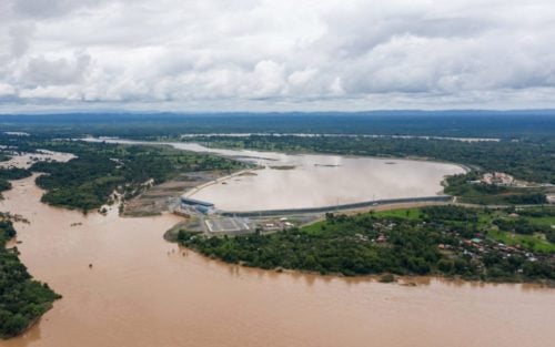
When Muy received the warning from the O’Svay commune chief ahead of that flood, the official told him the dam was breaking, he says. The Don Sahong Hydropower Dam in Laos did not break, but as they prepared for the approaching waters, Koh Pnov residents, who had long protested the concrete structure that looms on the Laos border upstream of their homes, expected the disaster would come from the dam.
In Stung Treng, the northern tip of the Cambodian stretch of the Mekong river, fishers and farmers are experiencing unexpected changes to their environment: disappearing fish, dying forests, eroding islands. As they grapple with changing natural cycles, villagers are projecting their fears onto the giant Don Sahong dam that looms upstream — though the true culprit may be bigger than just the one structure.
Natural Cycles Shaken
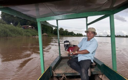
Sitting in the veranda of his small restaurant overlooking the Mekong and Laos, Poy Vanna, a former leader of ecotourism in Preah Rumkel village, where he oversaw dolphin tours, restaurants and shops, says there are just three dolphins remaining in this part of the river, and they no longer dwell at the nearby deep pools — which were once the main draw for travelers.
Since dam construction began, dolphins have moved away from the Chheu Teal deep pool in Preah Rumkel to live further up in the Laotian border due to explosions during construction, says Vanna, who takes tourists on boats to see the Mekong dolphins up close.
“Now we have to drive up to the Laotian border to see dolphins. The boat stays at the border of Preah Rumkel and the dolphins air themselves in the Laotian water,” he says, fearing tourists’ interest in the ecotourism village would fade if the dolphins disappeared.
Though the IUCN-red listed Irrawaddy dolphins that appear in Stung Treng’s deep pools were on the decline even before the dam’s construction began in late 2015, Vy Phalluy, provincial coordinator for the Stung Treng-based NGO Culture and Environment Preservation Association, says he suspects Don Sahong worsened the trajectory.
Dolphins had been one of the rallying cries throughout the early 2010s in protests against the dam led by the World Wildlife Fund, which has said the Don Sahong would “almost certainly cause” dolphins to leave their territories due to the excavation and increased boat traffic during the construction period and blocked fish migration during operation.
Phalluy says the natural cycle of the river’s water level has been thrown off.
On the waters of the Mekong River in northern Stung Treng — an internationally protected wetland called a Ramsar site — clusters of trees break through the currents and form sections of flooded forests, creating a habitat for fish to spawn and an otherworldly landscape that attracts local and foreign tourists. But many of the leafy branches are going bare and trunks are collapsing into the river: Phalluy notes that the flooded forests are dying because water levels are no longer consistent with the patterns they followed before, where trees spent half the year dry and half of it immersed during the rainy season.
In August, a fish spawning month, the water should have been at the banks, but it was still close to the riverbed, hurting fishes’ ability to lay viable eggs, Phalluy says.
“We are seeing dramatic changes in the water level,” Phalluy says. “The water level did not rise [on time], but when it rose, it rose quickly, like a flash flood.”
When the flood last September caused thousands to evacuate from Stung Treng’s riverine islands, it coincided with a period where the Don Sahong dam closed its gate, he recalls, suggesting it could have pushed the water downstream and caused the flash flood effect. According to Phalluy, the flash flood events reminded villagers of the collapse of the Xe Pian-Xe Namnoy hydropower dam, a major disaster in Laos that displaced 17 villages in neighboring Siem Pang district.
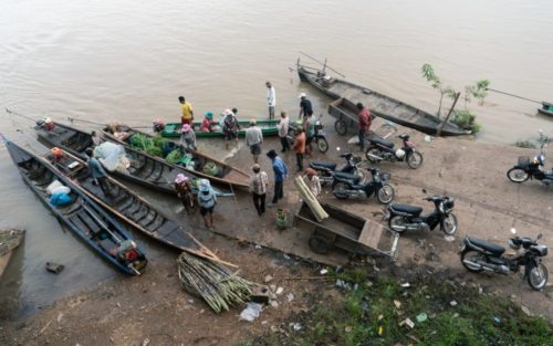
Before the flood last year, the island of Chheuteal Touch had never experienced any erosion, says village chief Sai Feng. But the floods of last rainy season changed that, he says. Some villagers had preemptively moved their homes inland in 2018, as they saw the Don Sahong dam nearing completion and predicted floods once it turned on, Feng says. One family on the island who did not make the move completely lost their land and house to erosion, which spanned 200 meters, and the family was forced to leave the island after last year’s flood.
History of Controversy
Researchers say that despite the fears that Don Sahong conjures in nearby villagers’ minds, it is the whole chain of hydropower dams built on the Mekong’s mainstream — 13 operational dams from China through Laos — and not Don Sahong alone that is disrupting the river’s ecology.
Ian Baird, a Southeast Asian studies researcher based at the U.S.’s University of Wisconsin-Madison who has conducted extensive research in Cambodia and Laos, was one of the first researchers to raise concerns about the dam with a series of papers about the importance of the Sahong channel, where the dam sits, to migratory fish that travel from the Tonle Sap, past the nations’ border and through Laos’ 4,000 Islands.
But when asked about the Don Sahong dam in August, Baird says the dam was actually having minimal effect on Cambodia, diverging from his original research on its potential impact.
The dam was planned and built on the Sahong channel, which had been the main pathway for migratory fish that travel between Cambodia’s Tonle Sap and its breeding areas in Laos, and as such many researchers and activists had campaigned against it since Mega First signed a memorandum of understanding with the Laotian government in 2009.
When the Laotian government announced its intent to build the dam to the region’s Mekong River Commission in 2013, letters against the dam turned to full blown protests at the Cambodian border, at one point drawing as many as 600 protesters.
Now that the dam is operational, Baird says his view of the Don Sahong “changed completely,” because he was not aware that the company intended to open the Sadam channel.
“On the Cambodia side, people don’t really know what’s been going on [in the Mekong River] and don’t understand what’s happening,” he says. “The dam is right there in front of them, and it was on the biggest channel in front of them … [but] I don’t think you can attribute the effects [they’re seeing] to the dam.”
Peter Hawkins, an environmental consultant evaluating the site leading up to the construction, claimed the company took significant efforts to ensure fish could still pass Laos’ Khone Falls.
Hawkins says he studied the passages surrounding the Sahong channel, testing whether fish had an alternate route. The company then blasted the Sadam channel clear, releasing a research paper with video footage to prove to activists and observers that fish used the cleared channel as an alternative pathway.
“Another preconception is that fish have some unerring sense of going upstream, and if it’s blocked, it’s not possible and the fish cannot migrate,” he says. “In reality, they try to find a path. Their first choice is always one with the most water, and they will choose another if they can’t get through.”
Hawkins suspects that not all the fish were willing and able to find the safer path, and some fish and larvae died in the turbines trying to make their instinctual migrations.
Kent Hortle, a fisheries and environment consultant hired to monitor the hydropower dam, says the company is monitoring fish loss through the turbines. The researcher says in an email that “many thousands of fish” have been using the passage, pointing to the same video-based report about fish using the Sadam channel instead of the blocked Sahong.
As for the major flood event last September, Hortle says the flood occurred while the dam was not operational, and claimed that erosion had been a problem in the Khone Falls area since the 1990s.
But whatever Don Sahong’s mitigation efforts, the Mekong’s flow is still becoming erratic and its fish and trees are vanishing. Researchers point to unfettered overfishing as one culprit, while early this year a report from U.S.-based research agency Eyes on Earth used satellite imagery to link unseasonable water flows to the cascade of dams in China.
Thailand experienced record-low river levels and worsened droughts last year, leading to drained reservoirs and to the ocean flowing into freshwater sources. Eyes on Earth notes that unexpected river flow conditions — high water levels in the dry season and lower levels in the rainy season — started around 2012 and steadily worsened as China brought more mainstream dams online.
Officials in Beijing full-throatedly denied the report, saying the country also struggled with droughts and low reservoir levels, and the riparian nations’ Mekong River Commission too argued that the report’s projections were oversimplified. However, MRC has repeatedly called for the Chinese government to release more extensive water level data all year, instead of only during the flood season.
Flipping through pages of a field guide on fish, Kong Chanthy, a leader of an O’Svay commune community fishery from 2002 until last year, points out a dozen species that are harder to spot in the water, if not disappeared altogether.


